A devastating chain of ice, rock, water and human vulnerability has left Nepal confronting one of its most complex disasters in recent years.
KATHMANDU: On the morning of August 26, the Himalayan landscape of northern Nepal changed in a matter of minutes. High above the valleys of Rasuwa, a massive section of rock and glacier ice collapsed from the Langtang Lirung mountain. The falling mass crashed into the Lhende Khola, carrying with it enormous quantities of rock, soil and debris. As the surge moved downstream, it entered the Bhote Koshi and Trishuli river systems, transforming a mountain collapse into a disaster that would eventually affect communities, hydropower projects, roads and bridges across a large part of central Nepal.
What began high in the mountains quickly became a humanitarian emergency on the ground.
The disaster was initially described in some reports as a glacial lake outburst flood. However, subsequent scientific analysis has pointed towards a more complicated sequence involving an ice-rock avalanche, debris flow and sudden river surge. Scientists continue to examine the precise chain of events that turned the mountain collapse into such a destructive flood.
The distinction is important because the disaster did not begin with an extraordinary spell of rainfall.
It began with the mountain itself giving way.
How did the disaster begin?
The Langtang region is part of one of the world’s most geologically fragile environments. Steep mountain slopes rise sharply above narrow valleys through which rivers carry water and sediment towards lower settlements.
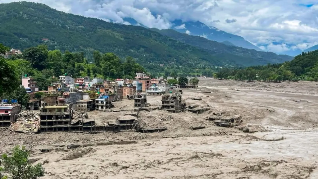
When the huge mass of ice and rock detached from the mountain on August 26, it plunged into the valley below. The impact disturbed the river system and generated a rapidly moving mixture of water, rock, mud and debris.
As the flow travelled downstream, it gathered more material from the valley, increasing both its size and destructive force.
This is what made the event different from an ordinary flood.
Floodwater can inundate a settlement. A debris-laden surge can carry boulders, trees, vehicles and fragments of buildings with it.
The river was no longer simply carrying water.
It was carrying the mountain.
The US Geological Survey later determined that seismic signals initially associated with an earthquake were actually generated by the massive slope collapse. Scientific assessments have also examined whether temporary river blockage and subsequent release contributed to the downstream surge.
The exact sequence is still being studied, but one fact is clear: the disaster originated in the high Himalayas and intensified as it moved towards populated areas.
Why was the destruction so severe?
The answer cannot be found in the mountains alone.
It also lies downstream.
The Trishuli corridor is an important economic and transport route in Nepal. Roads, bridges, settlements and hydropower projects have developed along the river valleys because these locations provide access to water, transportation routes and energy resources.
That development, however, also places people and infrastructure in the path of natural hazards.
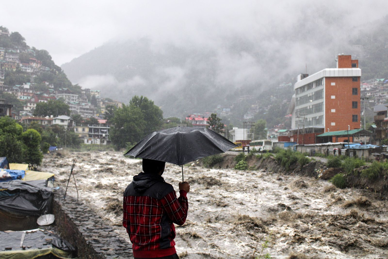
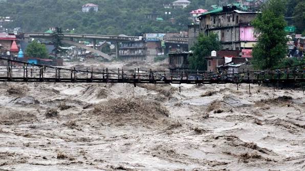
When the flood arrived, bridges were swept away and roads disappeared under mud and debris. Hydropower facilities were severely damaged, while workers inside underground tunnels became trapped or unreachable.
For communities living along the river, the warning time was extremely limited.
There was no long period in which families could calmly pack their belongings and leave.
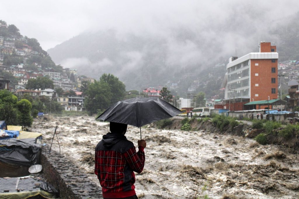
For many, the flood arrived as a sudden wall of water and debris.
What happened to the people?
The numbers tell only part of the story.
By September 10, Nepal’s Ministry of Foreign Affairs reported that 13,656 people had been rescued, 1,377 bodies had been recovered and 5,130 people were still missing. The ministry also reported that hundreds of foreign nationals were among those affected.
By September 21, Reuters reported that the death toll had risen above 1,400, while approximately 5,700 people remained missing. The changing figures reflected continuing rescue, recovery and identification operations rather than a single settled final toll.
Behind every number was a family waiting for information.
For some, rescue meant being pulled from damaged buildings or isolated roads. For others, it meant waiting for news about relatives who had disappeared inside hydropower tunnels or along the river.
In several cases, the search continued long after the floodwater had receded.
Why were the hydropower tunnels so difficult to reach?
Some of the most challenging rescue operations took place underground.
The Trishuli corridor contains several hydropower projects, many of which depend on tunnel systems built deep inside the mountains. When the flood carried enormous quantities of mud and rock into these areas, conventional rescue methods became difficult.
Rescuers had to remove tonnes of debris, clear access routes and work in unstable conditions.
Heavy machinery and specialised equipment were brought in. Nepal’s security forces worked alongside international rescue teams, while forensic teams assisted in identifying recovered bodies through DNA sampling.
The objective gradually became twofold: finding anyone who could still be saved and giving families answers about those who could not.
How did Nepal respond?
The first response came from Nepal itself.
The Nepal Army, Nepal Police and Armed Police Force were deployed for search, rescue and relief operations. Helicopters were used to reach isolated areas, while heavy equipment was sent to clear roads and debris.
But rescue was only the beginning.
Once bridges had been destroyed and roads cut off, entire communities faced difficulties receiving food, medicine and other necessities.
Restoring connectivity therefore became one of the most urgent priorities.
By September, emergency bridges had been installed at some locations while road clearance and reconstruction work continued elsewhere. The government also began assessing damage to homes, roads, bridges, power infrastructure and agricultural land.
According to Nepal’s official assessment, hundreds of megawatts of hydropower capacity were affected, along with major transmission infrastructure.
The economic consequences are likely to continue long after the immediate disaster disappears from the headlines.
Who helped Nepal?
The disaster quickly attracted international assistance.
India provided emergency relief supplies and deployed specialised personnel to support rescue operations, particularly around damaged hydropower facilities. China also provided emergency assistance and participated in rescue and recovery efforts.
South Korea sent emergency-response personnel and humanitarian assistance, while the United Kingdom and United States also offered support.
International organisations including the United Nations, World Health Organization, International Federation of Red Cross and Red Crescent Societies, World Bank and European Union were involved in different forms of humanitarian, financial or technical assistance.
Forensic support also came from several countries, including India, China, Japan, Singapore and South Korea, particularly for DNA collection and identification of recovered remains.
The international response demonstrated something important about disasters in a connected world: the destruction may begin in one valley, but the responsibility to respond does not necessarily stop at a border.
But why did this happen in the first place?
This is where the story becomes more complicated.
The Himalayas are not static mountains.
They are constantly changing under the influence of geological processes, temperature, ice and water.
Climate change has added another layer to that instability.
Scientists have increasingly documented glacier retreat and changes in high-altitude environments across the Hindu Kush Himalaya. Rising temperatures can contribute to glacier loss and permafrost thaw, potentially weakening mountain slopes and altering the way water and sediment move through these landscapes.
But saying that climate change alone caused the Nepal disaster would oversimplify the science.
The immediate trigger was the mountain collapse.
Climate change may have contributed to the conditions that made the landscape more vulnerable, but researchers are still examining the exact relationship between warming, geological instability and the August event.
Nature created the hazard.
Human beings determined how exposed they were to it.
Did human development make the disaster worse?
There is no simple answer.
Nepal is a developing country with enormous dependence on its rivers and mountains. Hydropower is a major part of its economic future. Roads are essential for communities separated by difficult terrain. Settlements have developed around these transport and economic corridors for generations.
Moving all human activity away from mountain valleys is neither realistic nor necessarily desirable.
The question is therefore not whether Nepal should develop.
The question is how it should develop in a landscape where the risks are changing.
Infrastructure designed around historical patterns may not always be adequate for future hazards.
A bridge that can withstand an ordinary flood may not survive a massive debris flow.
A road built along a river may become inaccessible when the river suddenly changes course.
A hydropower project may generate valuable electricity but also require sophisticated monitoring and emergency planning because of the environment in which it operates.
The challenge is to make development more resilient rather than abandoning development altogether.
Could the disaster have been prevented?
Perhaps not entirely.
A mountain collapse of this scale cannot simply be switched off.
But the number of lives lost and the extent of damage may depend partly on what happens before the collapse.
Traditional flood-warning systems often rely heavily on rainfall and river-level measurements. That becomes a problem when the initial hazard begins thousands of metres above the river and is triggered by a sudden slope failure.
A rain gauge cannot necessarily warn a community about a mountain collapsing upstream.
This is why scientists and disaster-management experts are increasingly looking towards high-altitude monitoring systems, satellite imagery, cameras, sensors, river gauges, automated alerts and community evacuation plans.
Early warning is useful only when the warning reaches people in time.
A sophisticated satellite system is of little value if a village has no communication network, no evacuation route and no idea where to go.
Technology, therefore, has to be accompanied by preparedness.
What happens now?
The emergency phase may eventually end.
The consequences will not.
Families will have to rebuild homes. Roads and bridges will have to be reconstructed. Hydropower projects will require repairs or redesign. Communities that lost their sources of income will need support.
And the government will have to make decisions about where and how reconstruction takes place.
Rebuilding exactly what existed before may appear to be the quickest solution.
But it may also recreate the same vulnerability.
The more difficult approach is to rebuild differently.
That means stronger infrastructure, updated hazard maps, better monitoring of high-altitude regions, safer locations for settlements and critical facilities, and evacuation plans that work at the community level.
It also means closer cooperation between Nepal, China and other Himalayan countries because mountains and rivers do not follow political boundaries.
The bigger warning from the Himalayas
The Nepal disaster is ultimately larger than one flood.
It is a warning about what happens when a rapidly changing natural environment meets growing human activity.
The Himalayas will continue to produce rivers that sustain millions of people.
They will also continue to produce landslides, avalanches, floods and other hazards.
Human beings cannot eliminate those forces.
But they can understand them better.
They can monitor the mountains.
They can build differently.
They can create warning systems that reach people before disaster reaches their homes.
And they can recognise that climate resilience is not simply about protecting the environment. It is also about protecting roads, power plants, communities, livelihoods and lives.
The tragedy of August 26 began with a mountain collapsing high above Nepal.
Its real lesson, however, lies much farther downstream.
A natural hazard becomes a disaster when people are left exposed to it.
And as the Himalayas continue to change, the question Nepal now faces is no longer simply how to recover from the flood.
It is whether the country can rebuild in a way that is prepared for the next mountain to move.